How autonomous underwater vehicles explore the sea without a pilot
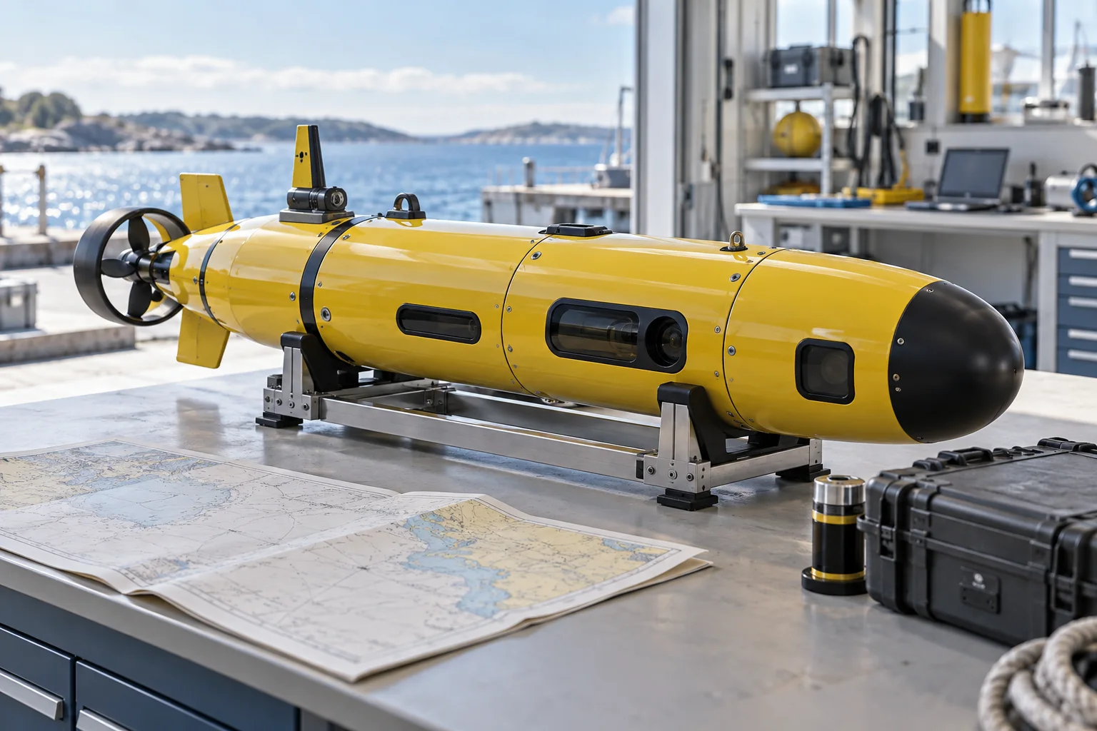
Autonomous underwater vehicles (AUVs) are uncrewed robots that carry out missions below the surface. They can map the seabed, measure currents and collect samples in places where a ship cannot safely follow. “Autonomous” describes how a vehicle carries out a planned task; people still design the mission, launch it, monitor what they can and recover the vehicle. See the AUV profile for a broader account of the field.
How an AUV differs from a remotely operated vehicle
An AUV has no pilot on board and no physical cable connecting it to a ship. It can carry cameras, sonar and depth sensors, and usually records its measurements on onboard computers. The data can be retrieved when the vehicle returns. A remotely operated vehicle (ROV), by contrast, is tethered to a ship and can send video back to its control room during a dive, as NOAA explains in its AUV overview.
| Vehicle | Connection to the surface | Typical data handling |
|---|---|---|
| AUV | No tether; follows its mission underwater | Stores data onboard for recovery |
| ROV | Tethered to a surface vessel | Sends video and data through the tether |
Ocean gliders can receive new instructions by satellite when they surface. During the 2016-17 Challenger mission, the team steered a glider from Rutgers University and the University of Western Australia; the glider surfaced to send back data and its position (International Indian Ocean Expedition).
What underwater robots measure
The instrument depends on the question. In 2018, an Autosub Long Range vehicle travelled beneath the Ronne and Filchner ice shelves to measure water properties and currents. The British Oceanographic Data Centre's PS111 cruise record places the work in the southern Weddell Sea.
The vehicle carried temperature, salinity and current instruments. One 48-hour mission beneath Filchner ended with the AUV about 750 metres from its recovery waypoint when the ship regained contact. The crew had to clear ice and guide the vehicle towards open water before recovering it (PS111 cruise report, pages 2 and 6).
Navigation and endurance set the limits
Beneath the ice, the vehicle could not surface for GPS fixes. It estimated position from its heading and movement, then needed to return within acoustic communication range so the ship could direct it to a safe surfacing point. The report describes this navigation and recovery requirement alongside the science objectives.
The report estimates roughly 12 days of endurance and 650 kilometres of range for that configuration at its stated operating speed. Those figures describe the vehicle's capability, not the duration or distance of its under-ice missions. The team chose shorter missions because working through ice added risks (PS111 cruise report, page 2).
What a mission proves about seabed maps
Individual dives can gather detailed measurements, but a successful mission does not mean the wider ocean floor is mapped. A 2025 peer-reviewed study used GEBCO bathymetry data to estimate how much seafloor had been mapped by direct measurement. It calculated 28.5 per cent for 2024, while Seabed 2030 had reported 26.1 per cent for that year. The authors attribute the difference to methods such as dataset resolution, boundaries and area calculations. Their study also found coverage varied by ocean basin and depth. The seabed mapping tracker follows the wider effort; the study does not show what share of global mapping was contributed by AUVs alone (Niyazi and colleagues, 2025).
AUVs contribute surveys to mapping programmes that combine data from several methods. When comparing results, check the location surveyed, the instruments used and how the measurements were processed. Explore more in the robotics and sensors sections.
Technology profiles
Making sense of robotics and artificial muscles
Read a robot demonstration as a description of a task in a particular setting. A useful account tells you what the robot handled, how the space was prepared and who intervened. Separate the body and actuators from the perception and control software. A convincing movement sequence leaves practical questions about repeatability, maintenance and the work required to deploy the complete system.
What to check in this field
Questions to take to the evidence
- Was the robot autonomous, remotely operated or following a prepared sequence? Check how a demonstration was selected and whether unsuccessful attempts are reported.
- What were the payload, reach, speed and operating conditions? Ask whether the same task was repeated with different objects, lighting and layouts.
- What surrounds the robot? Include charging, supervision, guarding, repairs and recovery from dropped objects or blocked paths when considering a proposed use.
What would make the future useful?
Future robots could take on a wider range of physical work if their complete systems meet the demands of a specific setting. Use an everyday task, with measurable success and failure, to assess that possibility rather than judging the appearance of the machine.
Explore the field: Humanoid robots · Artificial muscles and soft actuators.
Sources
- https://oceanexplorer.noaa.gov/ocean-fact/auv/
- https://iioe-2.incois.gov.in/IIOE-2/EP08-1Info.jsp
- https://www.bodc.ac.uk/resources/inventories/cruise_inventory/report/16405/
- https://www.bodc.ac.uk/resources/inventories/cruise_inventory/reports/polarstern_ps111.pdf
- https://www.frontiersin.org/journals/marine-science/articles/10.3389/fmars.2025.1543885/full
Checked against its sources by Codex AI editorial reviewer (separate from the drafter), 26 October 2026.